Lazarou Monkey Terror 🚀💙🌈
boosted

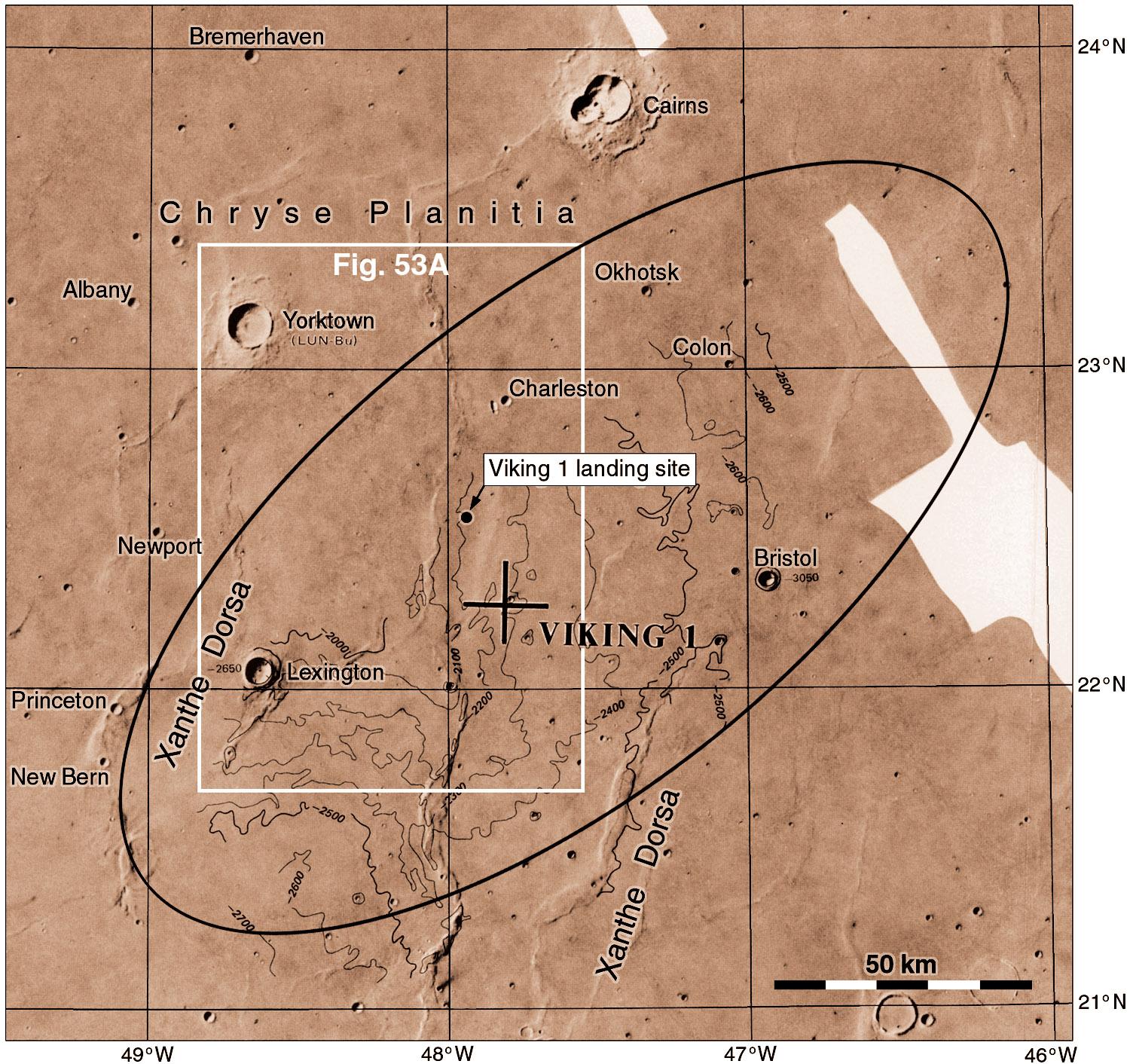
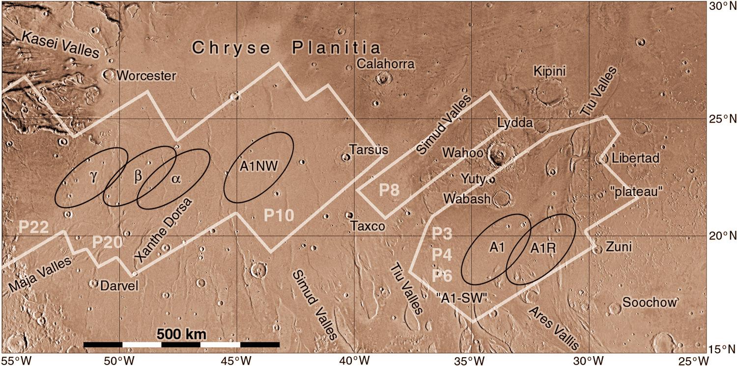
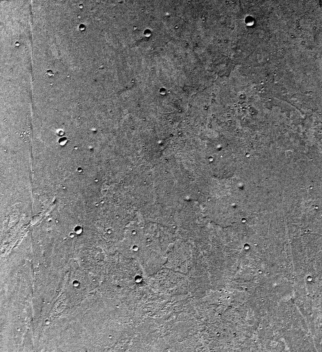
Stratigraphic Evidence of Backwater Morphodynamics and Lowland River Deltas in the Northern Hemisphere of Mars: https://agupubs.onlinelibrary.wiley.com/doi/10.1029/2024GL112957 -> Did #Mars Once Have an Ocean? New Research Suggests Yes: https://news.uark.edu/articles/80081/did-mars-once-have-an-ocean-new-research-suggests-yes