Discussion
Loading...

Post

  • About
  • Code of conduct
  • Privacy
  • Users
  • Instances
  • About Bonfire
Phil Stooke
@PhilStooke@mastodon.social  ·  activity timestamp 6 days ago

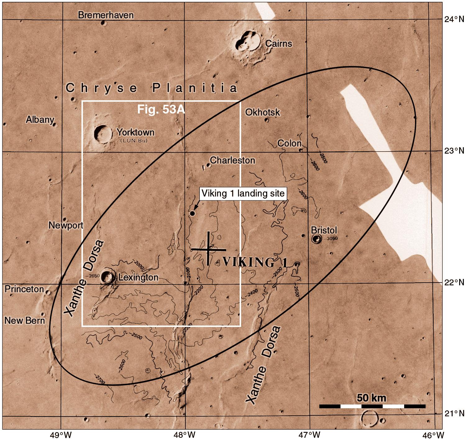
This is the final ellipse plotted on a USGS map. The large cross shows the post-mission estimate of the landing location. The actual site was found later (by Tim Parker of JPL) in better Viking images late in the mission, then seen clearly in HiRISE images. I was looking too, following advice from Merton Davies of RAND, but he and I were both wrong. Now it's time to get down on the ground.
#mars #viking

The final Viking 1 landing ellipse. The big cross shows the post-mission estimate of location and a dot shows the actual site found in HiRISE images. The base image is a USGS map with contours from stereoscopic imaging.
  • Copy link
  • Flag this post
  • Block
Log in

Open Science

We are a network of scientists, developers and organizations building the next generation of digital spaces for open science.

Open Science: About · Code of conduct · Privacy · Users · Instances
Bonfire open science · 1.0.0-rc.2.35 no JS en
Automatic federation enabled
  • Explore
  • About
  • Members
  • Code of Conduct
Home
Login