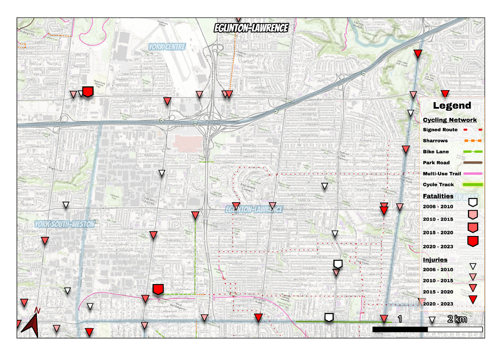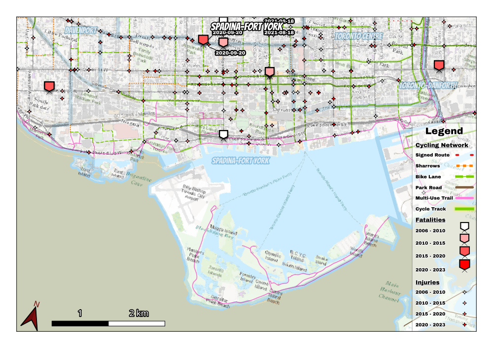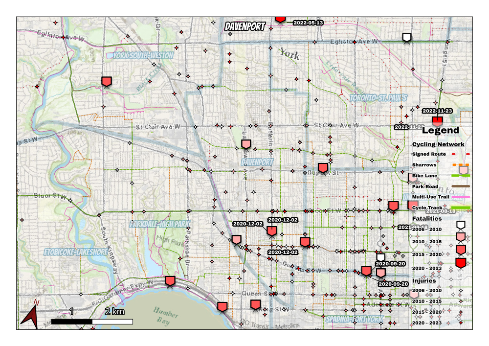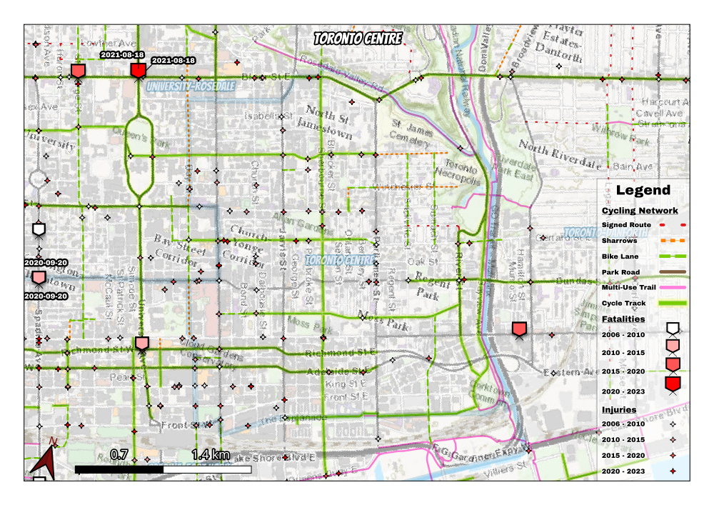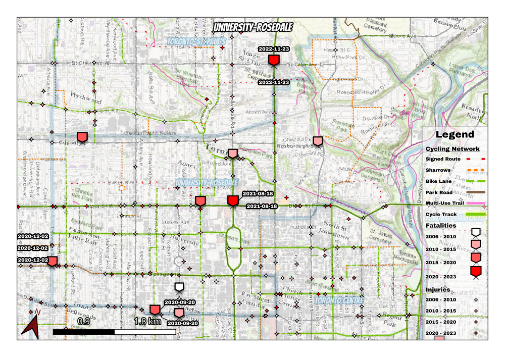

I made some maps today showing Toronto's cycling infrastructure and historical collisions with pedestrians and cyclists. I used open data from City of Toronto, Toronto PD, and ESRI for the basemap.
I don't think this is the final version so feedback is welcome! Is this sort of thing informative?