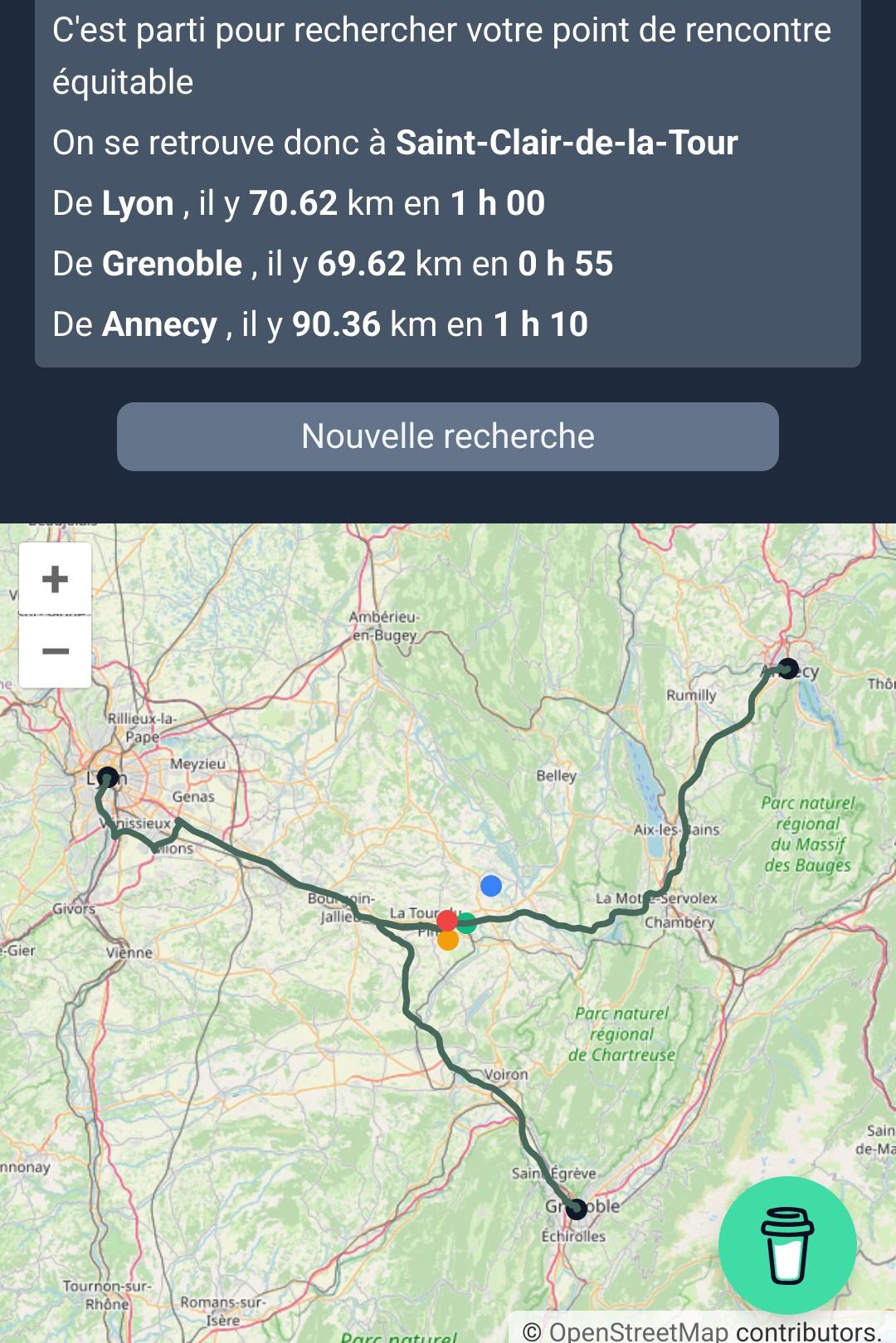

#Barry is an easy way to calculate a central meeting point by car or foot from any number of starting points using #OpenStreetMap and #Geoportail (hence currently works only in France) 🗺️ https://barry.gouz.dev/
Source: https://github.com/gouz/barry
Post
#Barry is an easy way to calculate a central meeting point by car or foot from any number of starting points using #OpenStreetMap and #Geoportail (hence currently works only in France) 🗺️ https://barry.gouz.dev/
Source: https://github.com/gouz/barry
@loleg This with trains would be so nice.
We are a network of scientists, developers and organizations building the next generation of digital spaces for open science.